BGF4
Type: Medium
SeyCCAT funds: SCR 999,955.00
Co-financing:
For this project, there is an expected co-financing of SCR 1,250,950.00 from Geomer Consulting; covering vehicles, GNSS equipment (RTK-DGPS), Total Station, Structure-from-Motion photogrammetry software, equipment and other analysis software.
SeyCCAT strategic objective: 1
Lead Project Partner: Jonathan Pinchart
Partners:
- Ministry of Agriculture, Climate Change and Environment (MACCE)
Coastal Adaptation Management Section / Climate Science and Data Management Section - Ministry of Land and Housing, Center for GIS
- National Institute of Science, Technology and Innovation
Duration: 24 months
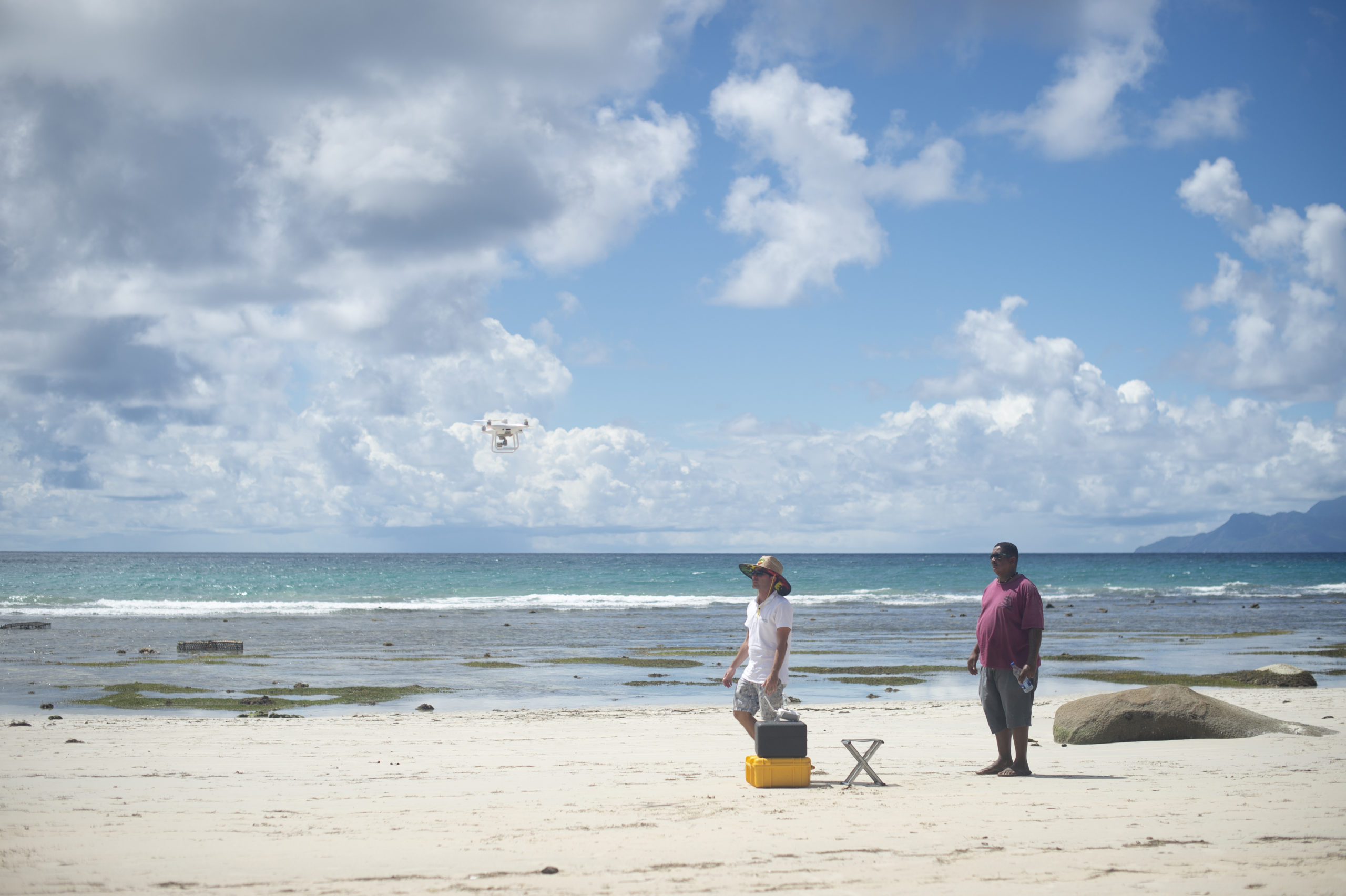
Jonathan Pinchart, head of a project to map the coastline of Seychelles using drone and GIS technology, waits for the team’s drone to land after a mapping session at Beau Vallon beach on the main island of Mahé on 7 December 2021.
Project story
Every year, thousands of tourists flock to Seychelles to enjoy its stunning sunshine, sparkling oceans, and pristine beaches. The country’s natural beauty is essential for high-value tourism, which contributes the most to the GDP, generates employment, and brings foreign currency. However, the value of Seychelles’ coastline goes beyond tourism. It is a vital part of the local way of life and is crucial to the livelihoods and resilience of the coastal communities.
Like other small island states, Seychelles is on the front lines of climate change. Rising sea levels and the loss of coral reefs cause more oceanic waves to reach the shoreline, leading to coastal erosion and beach loss. If left unchecked, this process threatens coastal communities, infrastructure, and Seychelles’ value proposition to foreign travellers.
Accurate data on coastal erosion processes is essential for policy and environmental management. However, such data is scarce in Seychelles, and the last comprehensive aerial survey of the coastline dates back to 2011. Collecting coastal data frequently enough for adaptive management is costly, complex, and time-consuming and requires specialized skills and equipment.
Fortunately, Geomer Consulting, managed by Jonathan Pinchart, has the technical expertise in coastal surveying and digital skills to process survey outputs. Using a large Blue Grants Fund grant, Jonathan purchased an aerial device with a high-resolution camera that can capture uninterrupted, continuous images of the coastline. Later, these images are processed using specialised software to create 2D and 3D maps that provide information on topography and landscape changes in the coastal zones.
The project employs unmanned aerial vehicles, or drones, an emerging technology in coastal management called UAV photogrammetry. It is a low-cost and high-precision option to obtain robust visual information to monitor coastal processes almost in real time.
The project is being implemented on the island of Mahe at four sites: North-East Point, Beau Vallon, Anse La Mouche, and Baie Lazare, which are identified as priority sites in the national Coastal Management Plan. The study area includes a coastal buffer zone and the beach, from the low watermark to duneland, to the extent of 25-40 meters inland.
The maps and datasets produced by Geomer Consulting will be used by the Ministry of Agriculture, Climate Change, and Environment, one of the project partners, to develop data-driven coastal management programs. The project outputs will be hosted on the National Knowledge Engagement Management Platform being developed by the National Institute of Science Technology and Innovation. All the information will be publicly available at no cost.
Project Application Form: Coming soon